
|
Welcome to DeKalb
County
|

|
|
|
Welcome to DeKalb
County
|
|
Do you have a DeKalb County Map to share with your fellow researchers? Just attach it to Email!
![]()
| 1850 Original Township Map | Included with the map is a
copy of the report of the commissioners charged with establishing the townships. Donated by the Joiner History Room. |
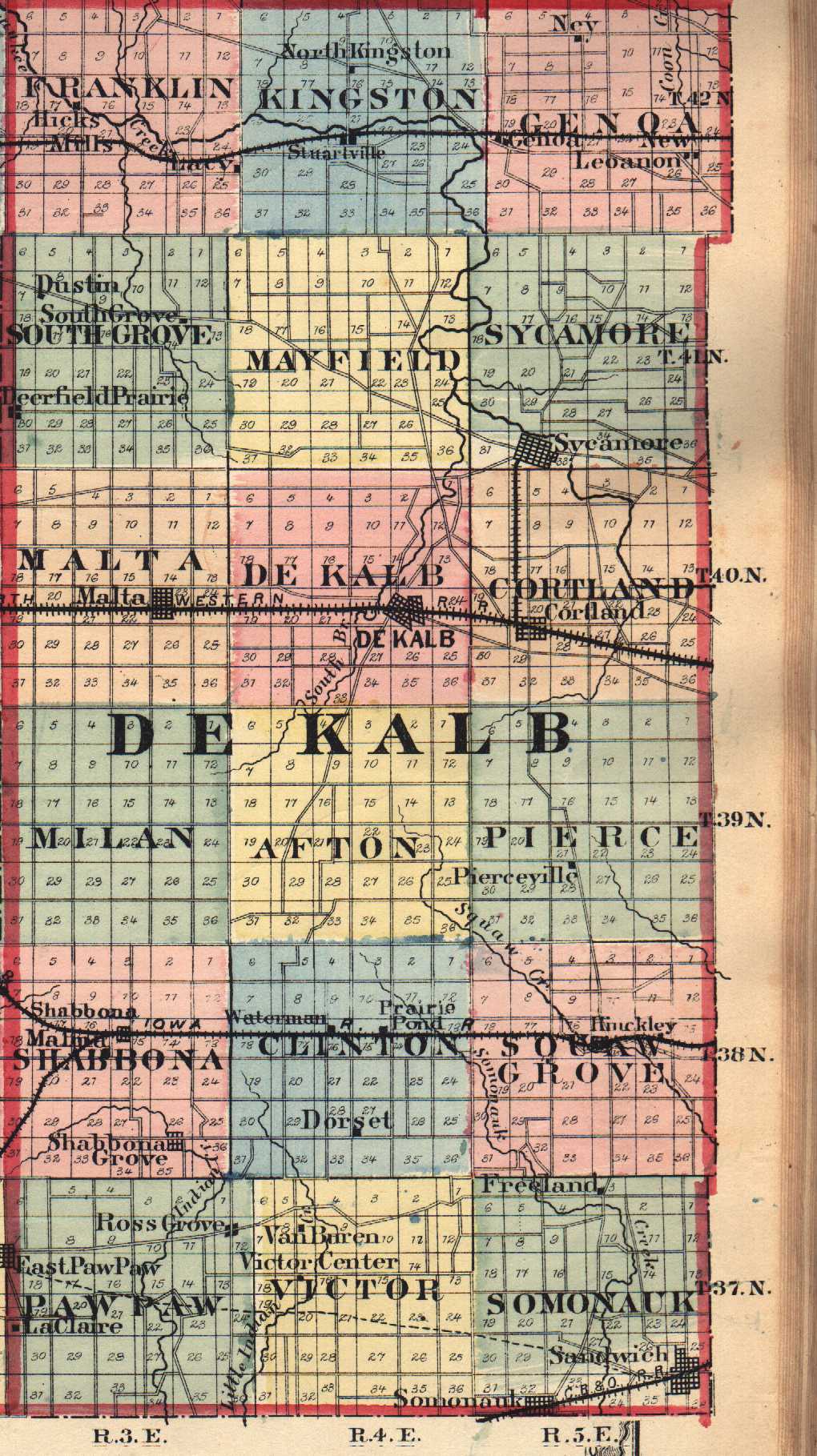
| 1875 County Township Map (Small Version -100 K) 1875 County Township Map (Large Version -345 K) allow 1.5 mins. |
Source: "Atlas of DeKalb Co. Illinois to which
is added an Atlas of the United States," Warner & Beers Publishers, Chicago, 1875. Submitted by: Alice Gless. <agless@earthlink.net> |
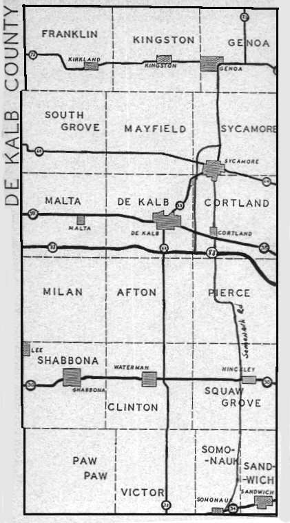
| County Township Map (48 K) |
Source: Back page of DeKalb County Clerk hand
out pamphlet. Submitted by: Jim Niewold |
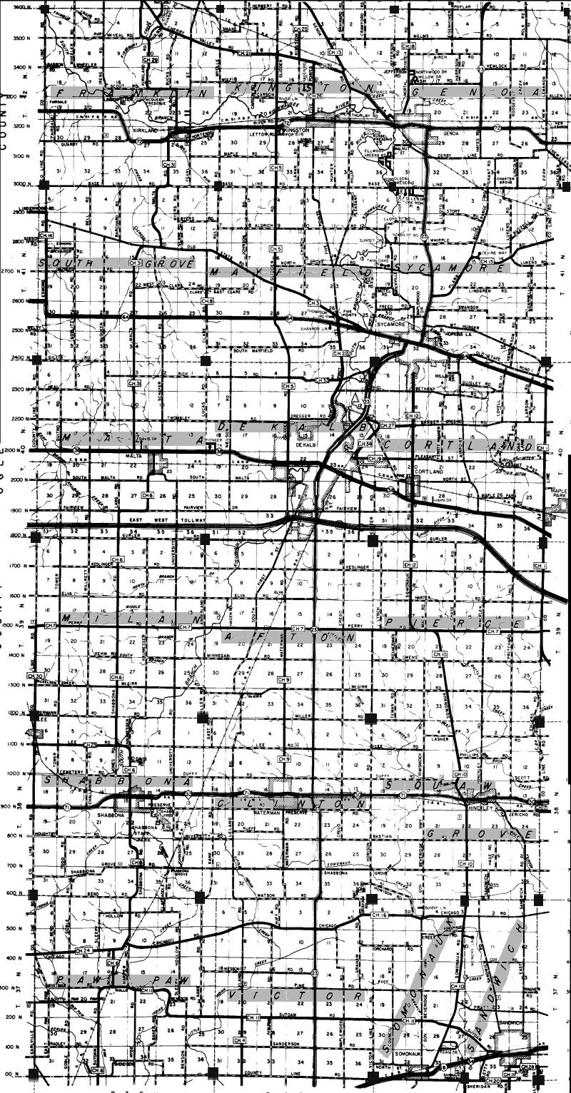
| County Township & Road Map (498 K) allow about 2 mins. |
Source: 1998 advertising map. Detailed county
road map. This map shows townships and sections. It takes some time to draw the map, but the wait is worth it. Submitted by: Jim Niewold |
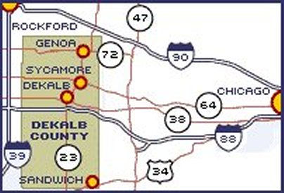
| County Location Map Small |
Small drawing that shows DeKalb County in relation to Chicago. DeKalb, Sycamore, Sandwich are about 60 miles west of Chicago. |
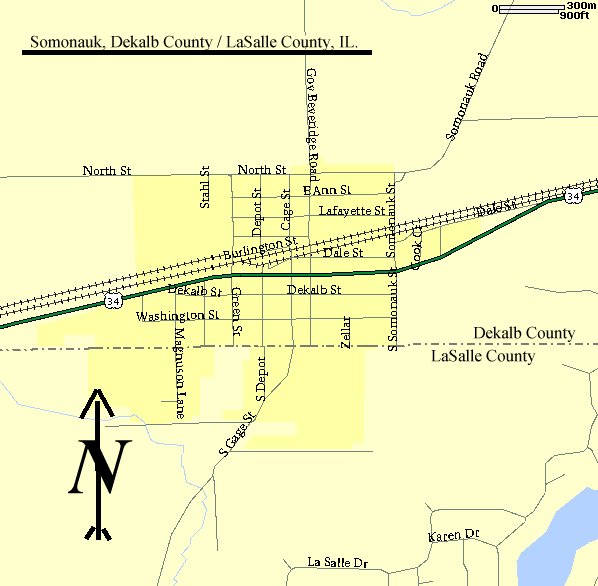
| Somonauk City Map Small |
This is a MapQuest map of village of Somonauk showing the county line and what parts of the village are in LaSalle county. Many Somonauk villagers didn't and don't live in DeKalb County. |
| ILGenWeb's County Boundary Maps 1790 - Present |
These maps show county boundaries at different
dates in time. Counties were formed as early as 1790 but DeKalb County was not formed till March 4, 1837. |
![]()
Return to DeKalb County
ILGenWeb
This page maintained by Sheryl Dowden at DKCGenWeb@comcast.net.
Copyright 2007 Sheri Baker. All Rights Reserved.
Copyright of
submitted items belongs to those responsible for their authorship or creation
unless otherwise assigned.